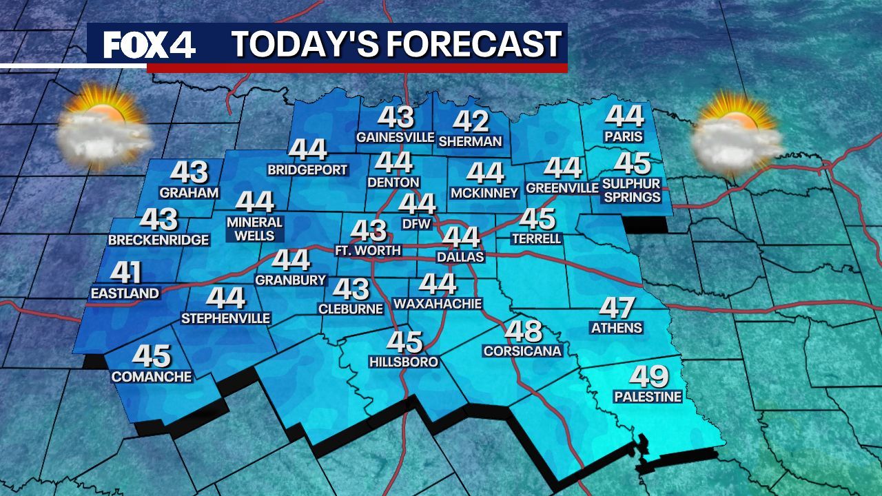
UPDATE: A severe cold front swept through North Texas on Thursday, plunging early morning temperatures below freezing across the region. As of Sunday, temperatures dropped to a chilling 29 degrees at Possum Kingdom Lake and 34 degrees in Dallas, with wind chills making it feel like the upper teens in some areas.
The strong winds are contributing to an intense wind chill factor, forcing residents to brace for frigid conditions. This weather front brought scattered rain and thunderstorms, resulting in over an inch of rainfall in some locations while others remained dry.
As the system continues to move east, it is causing significant travel disruptions across the Southeast, Mid-Atlantic, and Northeast, where rain is transitioning to sleet and snow. The upper-level low over the Great Lakes is expected to produce ongoing snowfall in that region.
Looking forward, North Texas is set to see improved conditions as we head into the weekend. Meteorologists predict that a southwest flow will keep cloud cover in place, potentially leading to isolated showers on Monday. Temperatures are expected to remain above freezing, minimizing the risk of any wintry precipitation. Rain chances sit at a low 20 to 30 percent, with isolated occurrences.
Residents can expect a gradual warm-up as we move into the week. Highs are predicted to return to the 50s on Tuesday and approach 60 degrees on Wednesday. However, forecasters caution that the week will feature more cold days than warm ones, with another significant system arriving on Thursday, bringing a greater chance for widespread rain and thunderstorms.
The upcoming weekend promises calmer weather and near-normal temperatures, providing a much-needed respite from the current chill. Stay tuned for more updates as conditions develop.
Make sure to share this urgent weather alert with friends and family to keep them informed!