UPDATE: The warmest weather of the year is hitting Myrtle Beach, SC, today, but a cold front is set to bring showers and potential storms this Saturday. Residents are urged to take note of changing conditions as warm temperatures peak before the weekend.
Today, gusty southwest winds are pushing temperatures into the lower 70s along the Grand Strand, with some areas reaching even higher. Expect wind gusts of 20-30 mph this afternoon, creating a dynamic weather environment. Beachgoers should be cautious as a DENSE FOG ADVISORY is in effect, particularly over the Atlantic, where visibility could become dangerously low.
Inland temperatures are on track to challenge record highs, with Florence potentially breaking the 83°F record and Lumberton nearing 80°F. This unseasonably warm weather is expected to provide a brief respite before the impending cold front.
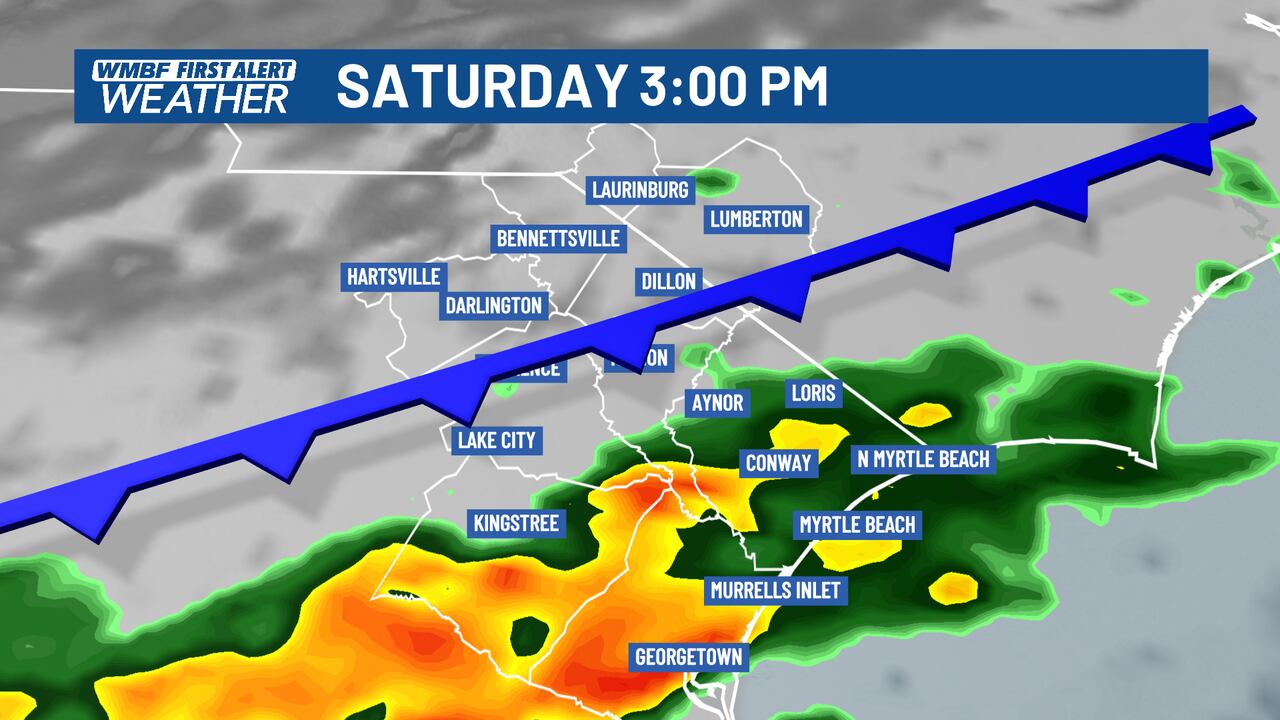
As we look ahead to Saturday, rain chances are increasing dramatically. Residents should prepare for intermittent showers during the day, with the most significant rain expected in the morning and again in the afternoon. There is a risk of thunderstorms developing as the cold front moves through the region. Despite the rain, temperatures will remain mild, reaching the lower to middle 60s.
Looking forward to Sunday, lingering showers are likely in the morning, followed by mostly cloudy skies throughout the day. Temperatures will take a noticeable dip, with highs struggling to reach the 50s. Breezy conditions will develop as cooler, drier air sweeps in.
Next week, residents should brace for a dramatic shift in the weather, with temperatures plummeting into the 20s and 30s during the mornings, and afternoons only managing to reach the 40s.
Stay tuned to WMBF for the latest updates and prepare for changing conditions. Share this urgent weather alert with friends and family to keep everyone informed!