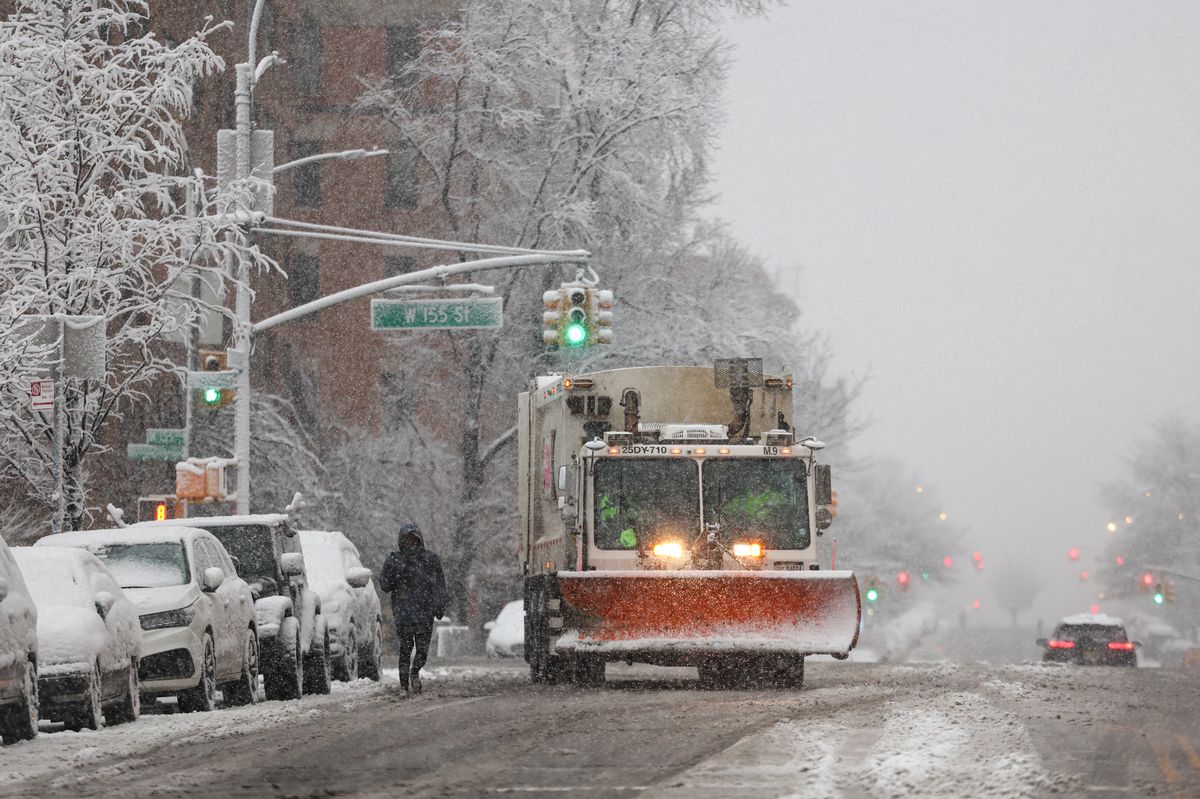
URGENT UPDATE: Approximately 72 million Americans are currently facing severe winter weather, as powerful winds and snowstorms disrupt holiday travel plans across the eastern and western United States. A massive weather system is sweeping eastward, impacting areas from the High Plains to the Northeast, with wind gusts reaching up to 60 mph in some locations.
Weather alerts are in effect, particularly for regions in Appalachia, New England, and coastal Maine, where conditions are expected to worsen throughout the day. Rain and wind will continue to batter communities from Washington, D.C. to Boston, creating dangerous travel conditions just in time for the holiday weekend.
The most substantial disruptions are anticipated on the West Coast, particularly in California, during the upcoming Christmas week. After dodging previous storms, California is now bracing for a series of powerful storms bringing intense downpours from this weekend through Christmas. This could trigger urban flooding, small-stream overflows, and potential river flooding, with some areas expecting up to several inches of rain.
AccuWeather’s Senior Meteorologist Adam Douty warns that “a somewhat larger clipper storm will affect parts of the Upper Midwest and Northeast from Monday to Tuesday.” This means travel disruptions are likely to peak on Tuesday, especially in regions from Pennsylvania’s Pocono Mountains to upstate New York and central New England.
In the Sierra Nevada and the Cascades, meteorologists predict multiple feet of snow at higher elevations, significantly impeding travel. “Snow levels will dip to pass levels at times,” noted AccuWeather Chief On-Air Meteorologist Bernie Rayno.
While the weekend forecast appears calmer, lingering winds and snow in the Great Lakes area will keep travelers on high alert. In contrast, states avoiding the winter blast are poised for one of the warmest Christmases on record, with temperatures soaring into the 70s and 80s Fahrenheit across at least a dozen states, including Texas, Missouri, and Georgia.
New Yorkers hoping for a white Christmas may be disappointed, as the holiday is expected to be dry and mild, with temperatures in the mid-40s. However, there is a slight chance of light snowfall early next week. As AccuWeather Senior Meteorologist John Feerick stated, “Even if we were to get a small accumulation, it would melt by Christmas.”
Historical data highlights that a white Christmas in New York City is quite rare. The last significant snowfall on Christmas Day occurred in 2002, when 5 inches fell in Central Park. In fact, only six times in the past 156 years has New York City recorded over an inch of snow on Christmas Day.
As travel plans are disrupted and weather conditions worsen, residents and travelers alike are urged to stay updated on the latest developments. With Christmas fast approaching, the impact of this weather system is felt nationwide.
Stay tuned for further updates as this story develops.