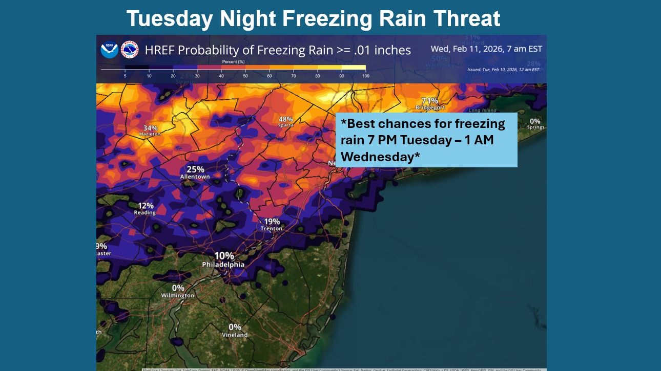
URGENT UPDATE: Freezing rain is anticipated tonight across parts of southeastern Pennsylvania and New Jersey, with a significant weather system expected to impact the region. The National Weather Service (NWS) has issued warnings for potential light icing, primarily affecting areas north of I-78.
According to the latest forecast from the NWS Mount Holly office, conditions are developing rapidly. Forecasters indicate that temperatures will dip to around 28°F tonight, creating a high risk for hazardous road conditions due to freezing rain. The NWS highlights that the precipitation may initially start as light snow, transitioning to sleet and then freezing rain as temperatures remain at or below freezing.
Tonight’s forecast: Expect mostly cloudy skies with light and variable winds shifting to the west at 5 to 10 mph after midnight. The potential for light icing could pose risks for drivers and pedestrians alike, making it imperative for residents to remain cautious.
Looking ahead, the NWS warns of another storm system that could affect the area this weekend. Precipitation is likely late Sunday into early Monday, with the best chances for impactful weather developing overnight.
Wednesday’s forecast39°F with westerly winds at 10 to 15 mph, gusting up to 25 mph. Conditions are expected to remain mostly cloudy throughout the day, with nighttime lows dropping to around 25°F.
Residents in the affected areas should stay informed about weather updates and prepare for potential travel disruptions. The combination of freezing rain and subsequent cold temperatures could lead to treacherous conditions on roadways and sidewalks.
For the latest developments and safety tips, keep following the National Weather Service’s updates. This is a rapidly evolving situation, and officials urge everyone to exercise caution as conditions change.
Stay safe and share this information with friends and family to ensure everyone is prepared for the weather ahead.