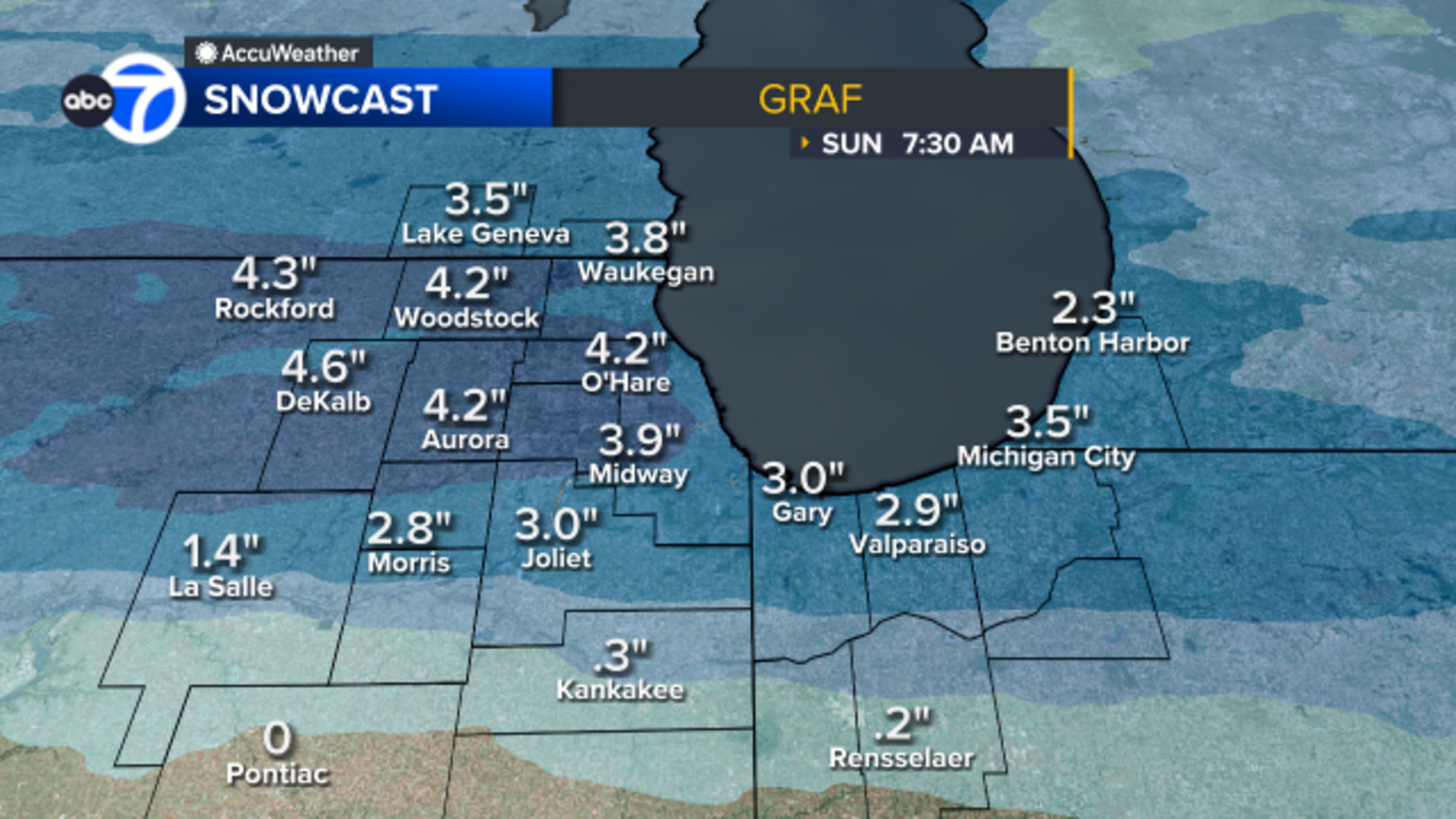
UPDATE: Heavy snow continues to blanket the Chicago area this morning, creating hazardous driving conditions across the region. The National Weather Service has issued multiple alerts as snow began falling between 9 p.m. Saturday and midnight, with accumulations expected to reach between 2 to 4 inches in some areas.
Meteorologists, including ABC7 Chicago AccuWeather’s Jaisol Martinez, report that snowfall is anticipated to taper off from west to east between 6 a.m. and 9 a.m. Sunday. By 5 a.m., areas south of Interstate 80 were primarily experiencing lingering flurries, but road conditions have deteriorated significantly, prompting urgent warnings for drivers.
The Chicago Office of Emergency Management and Communications has urged motorists to slow down and exercise caution. “Roads have become slick and snow-covered,” said Martinez, as the city braces for additional lake-effect snow through midday.
The Department of Streets and Sanitation confirmed that a Phase II snow program has been activated, deploying more than 220 salt spreaders citywide to ensure safety for emergency vehicles and public transportation. Crews are actively monitoring arterial streets, bridges, and overpasses for safe passage.
In some areas, particularly north of Interstate 80, snowfall could reach isolated totals of 4 inches. Meanwhile, regions including Kankakee, southern Will, Grundy, and southern LaSalle counties may see a mix of rain, impacting overall snow totals.
As temperatures are predicted to drop this afternoon, further snow accumulation is expected later tonight. Residents are advised to prepare for more snowfall this week, with an even sharper temperature decline forecasted for Saturday.
This ongoing winter weather not only affects travel plans but poses risks to public safety. Stay tuned for further updates as the situation develops.