UPDATE: A massive winter storm is wreaking havoc across the United States, leading to urgent snow emergencies from Montana to New York. As millions hit the roads for post-Thanksgiving travel, the National Weather Service (NWS) warns that this storm could impact nearly 42 million Americans.
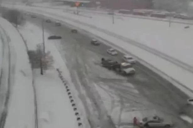
Videos are flooding social media with alarming footage of cars spinning out of control, particularly in St. Louis, Missouri, where witnesses report vehicles “spinning out left and right.” The National Oceanic and Atmospheric Administration (NOAA) confirms that winter storm warnings and advisories are now active across multiple states, signaling dangerous conditions.
This weekend is one of the busiest travel periods of the year, with AAA estimating that over 81.8 million people will travel at least 50 miles. Unfortunately, severe weather is complicating plans, as states declare snow emergencies amid growing concerns about road safety. The NWS has issued warnings for hazardous travel conditions across much of the Midwest, particularly eastern Iowa and northwestern Illinois, where snow squalls could create sudden whiteout conditions.
The storm has already proven fatal; in Alden Township, Minnesota, a 69-year-old man was killed by a falling snow-covered tree during strong winds, highlighting the immediate danger of this winter system. As of Friday, the storm began moving into the Pacific Northwest and quickly progressed through the Rockies, bringing snow to parts of the northern Plains.
As the storm continues its eastward path, significant snowfall is expected across the Midwest. Michigan is bracing for severe weather, with every county under either a winter weather advisory or a winter storm warning. Central New York could see up to a foot of snow, while areas in Iowa, Illinois, Wisconsin, and Michigan may experience even higher totals by Saturday evening.
The NWS predicts heavy snow, sleet, and an “icy mix” to blanket the region throughout Saturday, resulting in dangerous travel conditions. Chicago, a major air-travel hub, could face accumulations of 8 to 12 inches or more, and the potential for significant airport delays looms large.
While the storm does not officially meet blizzard criteria—defined by sustained winds over 35 mph and visibility under a quarter mile—it is still expected to feel like a blizzard for millions across the affected areas. The heaviest snowfall is anticipated downwind of Lake Superior and across Michigan’s northern Lower Peninsula, where totals could exceed a foot.
As thunderstorms and heavy rain threaten the western Gulf Coast, the NWS continues to monitor the situation closely. Travelers are urged to stay updated on conditions and prepare for potential delays and hazardous driving environments.
Stay tuned for more updates as this developing situation unfolds. Share this information with friends and family to keep everyone safe during this dangerous winter weather.