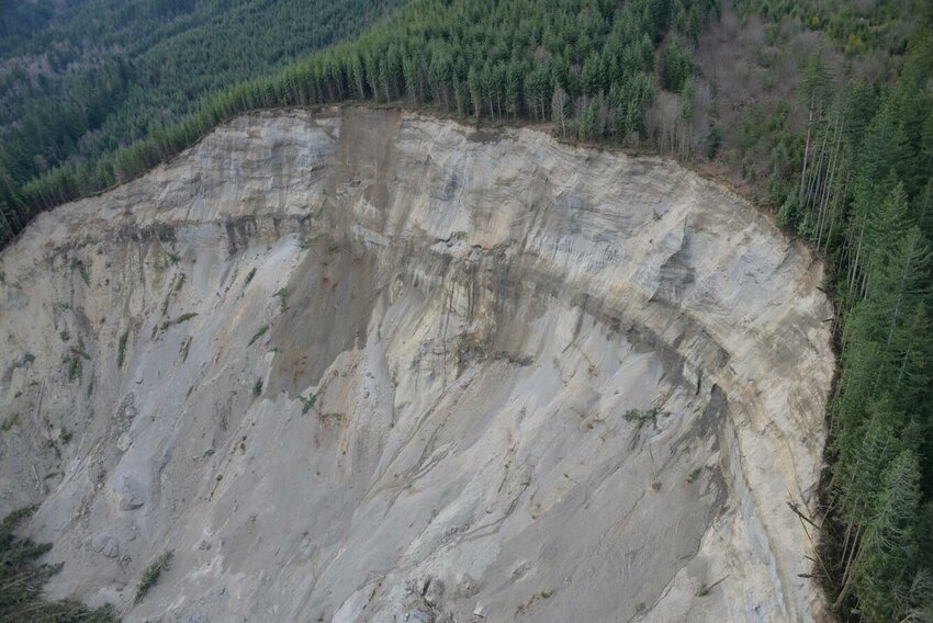
UPDATE: Critical landslide risk maps for Washington State remain incomplete more than a decade after the devastating Oso landslide, raising urgent safety concerns as the region braces for a second atmospheric river. The ongoing threat comes as more than 100,000 residents face evacuation orders due to record flooding, highlighting the dire need for accurate risk assessments.
Authorities confirm that while significant strides have been made since the 2014 Oso landslide, which claimed 43 lives, vital information about landslide-prone areas is still unavailable for much of the state. Joe Smillie, spokesperson for the Washington Department of Natural Resources, emphasized, “It is a knowledge gap and something we are hoping to address.” However, he noted that funding and manpower limitations hinder progress.
Despite $23 million appropriated by the Legislature since 2016 for a comprehensive geo-mapping portal, only a third of the state has been mapped. This includes 40,000 to 50,000 existing landslides documented so far. Areas like Pierce County and the Columbia River Gorge have been mapped for both existing and future risks, while places like King County rely on piecemeal mapping efforts.
With a second atmospheric river set to impact the area on Sunday, December 10, 2025, experts warn that shallow landslides could occur, posing a significant danger to communities already grappling with severe weather conditions. “We have more rain coming,” Kate Mickelson, who leads the state’s landslide mapping team, cautioned.
The current mapping efforts utilize advanced lidar technology, yet the complete risk mapping that correlates geological hazards to human safety remains elusive. University of Washington landslide engineer Joe Wartman stressed the necessity of such maps, stating, “There is a real advantage to knowing you are in a hazard zone.” He highlighted that understanding risk is crucial for survival, especially in light of extreme weather events.
As the National Weather Service issued alerts for heightened landslide risks, the Department of Natural Resources faced technical difficulties with its mapping tools, causing delays in providing critical information to residents. While the system was later restored, the urgency for comprehensive risk maps has never been clearer.
Residents are urged to stay vigilant and utilize available resources, as the absence of accurate risk mapping could lead to tragic outcomes in future storms. “When the rain comes, listen for the sound of snapping branches or the crack of the earth,” Wartman advised. This warning serves as a crucial reminder that preparedness can save lives.
Authorities acknowledge the progress made since the Oso tragedy, but without increased funding and personnel, the completion of vital mapping projects remains uncertain. As Washington prepares for continued rainfall and potential landslides, the call for action and accountability grows louder. Residents are left to navigate an incomplete safety net in a state prone to geological hazards.
As officials work to rectify these challenges, the community stands on high alert, hoping for a safer future as they await the completion of crucial landslide risk mapping across Washington State.