Severe tornado outbreak potential is escalating rapidly across the Great Plains and Great Lakes, with forecasters warning of an intense and possibly historic severe weather period unfolding in the final ten days of May. The renowned Euro Ensemble Model is issuing clear signals for a highly active tornado season pattern reminiscent of the dangerous 2004 outbreak, raising alarms for millions from the central Plains to the Great Lakes corridor.
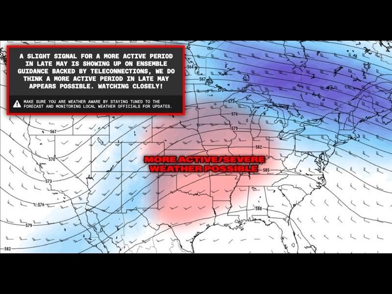
Data released from the Euro Ensemble 500mb wind analysis on May 7, 2026 outlines a classic trough-ridge atmospheric setup across the United States, a configuration that creates the ideal conditions for severe thunderstorms, explosive tornado formation, and long-track destructive tornadoes. This dynamic pattern fuels significant wind shear, moisture inflow, and instability needed for wide-ranging severe weather outbreaks.
Historic Tornado Season Signal Sparks Urgent Public Awareness
Meteorologists stress that while this forecast window still retains some uncertainty, the consistent teleconnection data backing the model runs increases confidence that the tornado threat will surge dramatically as May ends, extending into June. Comparisons to the violent 2004 tornado season highlight the potential for a sustained period of significant tornado activity that could impact multiple states simultaneously.
“If these signals verify, we could see a series of powerful tornado outbreaks across the Great Plains, Mississippi Valley, and Great Lakes that rival one of the most active seasons in recent history,” noted a senior meteorologist familiar with the model data.
This emerging weather pattern places vast populations—including those beyond the traditional tornado alley—at elevated risk. Authorities and emergency services throughout affected states are being advised to prepare for rapidly evolving conditions that could strike with little warning during this critical late spring period.
Residents Urged to Take Immediate Precautions
Communities within the threat zone from the central and southern plains northward to the Great Lakes are strongly urged to review emergency plans and confirm weather alert systems are fully operational. With the potential for multiple outbreaks, preparedness is key to minimizing injuries and protecting lives.
Delaware residents should stay tuned to trusted sources for updates, particularly if storms shift eastward in coming weeks, as large severe weather systems can span hundreds of miles.
The latest long-range model trends suggest this pattern will begin unfolding within days, potentially ramping up rapidly. Local and national meteorological agencies will be closely monitoring these developments, issuing watches and warnings as conditions materialize.
The takeaway: severe weather season is arriving in force, and it has the potential to be one of the most dangerous in over two decades. Staying informed, vigilant, and prepared is critical starting now.
For ongoing updates, detailed forecasts, and expert storm analysis across the U.S., follow trusted meteorological resources and local alert services.