UPDATE: A significant winter storm is set to hit Central Indiana tonight, with forecasts predicting 3-5 inches of snow, especially impacting the evening commute. As colder air settles in, residents should prepare for hazardous travel conditions beginning after dark.
The WRTV Storm Team confirms that gusty winds have already ushered in much colder temperatures, with lows expected to drop to the middle 20s Fahrenheit overnight. While Thursday will be marked by gray skies and some flurries throughout the day, the real concern lies in the anticipated snow accumulation starting this evening.
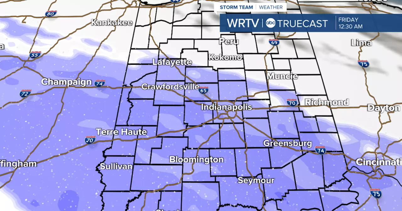
As of now, a band of 1-3 inches of snow is likely along and southwest of a line from Lafayette to Richmond, with the possibility of more significant accumulation across central and southern regions. Meteorologists warn that conditions may worsen, leading to difficult travel for those commuting during peak evening hours.
Weather forecasts indicate that snow will begin to overspread much of Central Indiana by Thursday night, with the potential for another light snow event occurring on Saturday. The cold snap will continue, with temperatures struggling to reach the single digits by Sunday, creating dangerously low wind chills.
Residents are urged to stay updated on weather conditions and plan for delays or cancellations. The Indianapolis forecast for tonight predicts cloudy skies with lows around 25°F. Tomorrow’s high is expected to reach only 31°F before the snow arrives.
This developing situation calls for immediate attention, as the impact of this storm could disrupt daily life and travel across the region. Stay tuned for further updates and ensure you have essential supplies ready.
For ongoing updates, check local weather alerts and heed any advisories issued by the National Weather Service.