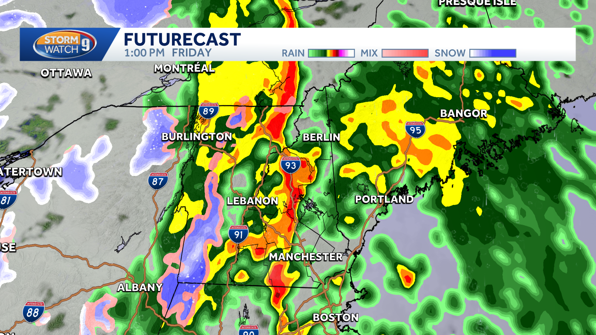
UPDATE: New Hampshire is bracing for intense weather today, with gusts reaching up to 50 mph and heavy rain expected to disrupt travel. A wind advisory is in effect from 8 a.m. to 7 p.m. as conditions deteriorate across the state.
Early Friday, residents experienced mild temperatures and fog, but the forecast is rapidly changing. By midday, a band of torrential rain will sweep through, bringing local downpours that coincide with the strongest winds. Travelers should prepare for significant impacts, especially between 11 a.m. and 3 p.m. as the storm front moves in.
The heavy rains are predicted to taper off by the evening commute, but a notable temperature drop is anticipated. Winds will shift to the west-northwest, potentially drying out roadways before the evening, yet there remains a risk for icy spots overnight into Saturday.
As temperatures drop, highs on Saturday will only reach the 30s, with additional gusts affecting the eastern slopes of the White Mountains. While the weather is expected to calm down ahead of a busy weekend of travel and holiday shopping, some mixed or snow showers could still occur on Sunday, marking the first day of winter.
Residents are urged to stay informed. Download the free WMUR app for real-time updates and alerts tailored to your location. Be prepared for hazardous travel conditions, and keep a close watch on changing weather patterns throughout the day.
Stay safe and plan accordingly as New Hampshire navigates through this challenging weather event.